Community & Business
6 July, 2024
Mapping the way
When you think of mapping uncharted territory, you likely envision swashbuckling rogues sailing the seven seas. In today’s technology driven world, these adventurous souls embarking into unknown territory get a little more nuanced with their cartography.
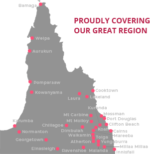
Atherton business ManGoesMapping offers affordable mapping and geospatial services that allow clients to better understand the land they live on, what data is available in that space, and how to utilise it.
“People call [GIS] geographic information systems, I call it a decision support system,” said founder Alistair Hart.
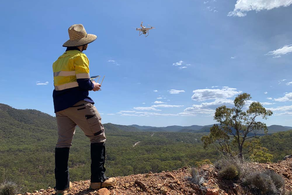
Geospatial technology and geographical information systems, also known as GIS, is a rapidly growing field that allows precise measurement of an area, with some technology able to remotely and accurately pinpoint data within an egg-sized location.
When Alistair started in the industry in 1999, he was told that the industry was worth a billion dollars globally.
“By 2005 it was worth $25 billion, by 2016 it was worth $250 billion and it is forecast to be a trillion-dollar industry by 2030.”
A play on mangoes and ‘man goes’, ManGoesMapping was named as a celebration of life in the tropics. A values driven company, the small team dedicated to making information and surveying techniques accessible to clients and to the Tablelands community.
The company also sells affordable technology and offers free training materials both on its website and on its YouTube channel.
Mangoesmapping has assisted the Queensland government with intermediating abandoned mine sites, supported local councils with disaster management, and provided hardware and training for agricultural operations, development planning and resource management.
“GIS becomes the mortar between these bricks of information and becomes a pathway for [clients],” Alistair said.
Now 30 years into his career, Alistair started his career in the field as a surveyor’s assistant before beginning to work for the Queensland Government. At the beginning of his GIS journey, Alistair was too busy working to attend classes and dropped out of university, which subsequently got him banned from all universities across Australia. After requesting data years later from his former university, he chuckles as he recalls his return to his former course as a guest lecturer.
“Life overtakes me every time I go to university,” Alistair said. “There’s other stuff that seems to be more relevant.”
Alistair started the company 10 years ago this October after 17 years working for the Queensland Government, most recently with the Tablelands Regional Council, before beginning this endeavour.
“Approximately 80% of public sector data has an element of location to it. What is where, where is what,” Alistair said. “We work with council to support their effective consumption of geographic information to streamline, to inform their decisions.”
Head of media and communications with Man Goes Mapping, James Leech and Alistair have a familiar rapport, comfortably bouncing ideas and explanations off each other.
“Some of our clients, they don’t even know where their assets are yet,” James said.
Citing the importance of recognizing the own data points necessary to a company - whether that’s a volumetric survey to figure out the amount of gravel in a pile on a farmer’s lot or the pathway of a water pipe through a property only one person is familiar with - the educational, service orientation of the ManGoesMapping services remain a core value for the company.
“We’re empowering the whole team to have that knowledge – it’s not just tied up in an individual. It’s kind of like democratising the intelligence of the system,” James said.
Echoing that sentiment Alistair added, “You can’t manage what you can’t measure.”
The company loves Atherton and at its core wants to continue contributing to the area it calls home. With his background in public service, Alistair’s passion for both the topic and the region is palpable.
“We have a growth agenda and we want to employ more people from the Tablelands. 98.5% of our revenue is not from the Tablelands, but our local revenue is important to us because it allows us to spend more time with our family,” Alistair said.
The business recently won Champion Business at the 2024 Tablelands Business Excellence Awards, and is committed to continuing its work in the Tablelands region.
Alistair passionately believes this technology can help everyone, when properly utilized.
“We’re so privileged to have access to this technology and understand how to use it; how can we leverage that knowledge in a way that delivers good not evil?,” said Alistair.
With a ‘teach a man to fish’ mentality, Alistair believes that the industry is if not invisible then certainly inconspicuous. The company is continually expanding, growing on average 30% per annum since its inception.
“Surveying offers this interesting crossover of playing with this cutting edge technology and delivering outcomes for society, and doing it in a way that you get out into the sunshine every now and again too.”
“It’s not just about accumulating wealth for myself or the business, it’s about delivering for everyone. I want the world to be a better place.”
For anyone interested in learning more about GIS, the company has a YouTube channel where they offer free lessons and explanations on various techniques, and their website offers plenty of training and informational overview on the subject.