General News
9 March, 2020
BOM forecasts possible flooding for this week.
BOM farecasts possible flooding for this week.
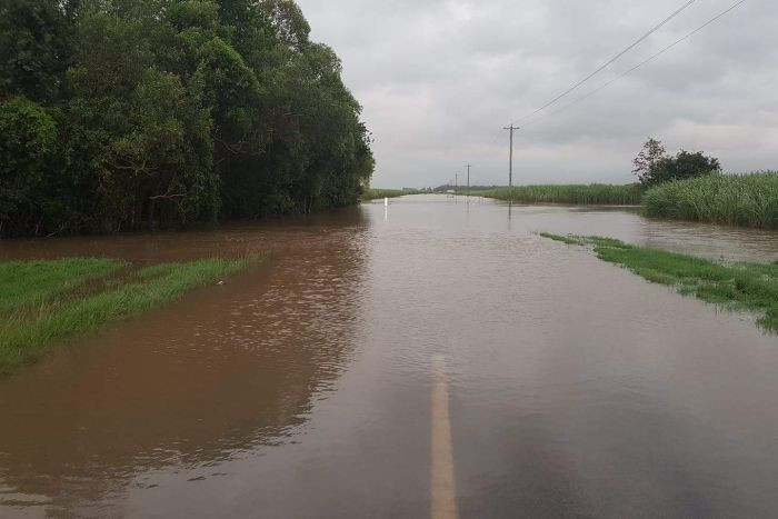
The Bureau of Meteorology has forecast possible flooding between the Cape York Peninsula and coastal catchments south to Mackay from Wednesday this week.
Widespread heavy rainfall is possible from Wednesday, associated with the likely development of a tropical low/cyclone in the Coral Sea and a separate area of heavy rainfall moving up the east coast.
Rainfall totals over northern parts of the Flood Watch area are very dependent on the location, development and movement of the tropical system. At this stage, it is likely that the system will move southeastwards away from the Queensland coast which would lead to an easing of rainfall from Friday.
Catchments within the Flood Watch area are relatively wet from rainfall over recent weeks and will, therefore, be more responsive to heavy rainfall, with riverine flooding possible from Wednesday.
Localised flooding and disruption to transport routes is possible throughout the Flood Watch area, particularly in the areas of heaviest rainfall.
Catchments likely to be affected include:
Jardine River
Ducie, Jackson and Skardon Rivers
Wenlock River
Embley and Mission Rivers
Watson River
Archer and Coen Rivers
Holroyd and Kendall Rivers
Coleman and Edward Rivers
Mitchell RiverStaaten River
Jacky Jacky Creek
Olive and Pascoe Rivers
Lockhart River
Stewart River
Normanby River
Jeannie River
Endeavour River
Daintree River
Mossman River
Barron River
Mulgrave and Russell Rivers
Johnstone River
Tully River
Murray River
Herbert River
Black River
Ross and Bohle Rivers
Haughton River
Burdekin River to Burdekin Falls Dam
Burdekin River downstream of Burdekin Falls Dam
Don and Proserpine Rivers
Pioneer River