General News
1 February, 2022
We're on the road to nowhere
New road not needed for 30 years, says access report
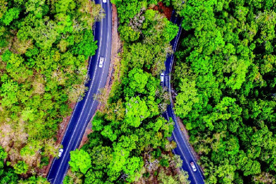
THE Kuranda Range Road will remain as the key transport link between the northern Tablelands and Cairns after a long-awaited government strategy concluded there was no need to provide an alternative road until at least 2051.
According to the State Government’s $1.6 million Cairns to Northern Tablelands Access Strategy, the Kuranda Range Road has the capacity to manage traffic for the next three decades, but it does acknowledge another transport link will be required and that investigations will be needed to identify the best route.
But Minister for Main Roads Mark Bailey said any investigations into major upgrades or new routes were not immediately warranted.
“What this study tells us is there is currently no clear technical justification for a major upgrade of existing routes, or construction of a new road along a new alignment,” he said.
“There is no need for the deceptively named ‘bridle track’ that is in fact a proposed new highway which would plough through National Park between Cairns and Mareeba – destroying unique ecology in the Dindin National Park in the process.
“With 12 kilometres of proposed tunnelling involved in this track, it would be a multi-billion dollar project without any need or justification that would destroy an estimated 140 to 160 hectares of rainforest, resulting in the loss of approximately 80,000 to 100,000 mature trees.
“This proposed highway is a project no government would ever build due to its hideous cost and destruction of a heritage listed national park.
“Based on real data to come from this study, our main planning priority remains identifying a long-term plan for the bridge over Barron River near Kuranda.”
Member for Barron River Craig Crawford said the strategy had delivered a roadmap of initiatives and investment over the short, medium and long term to deliver the “right infrastructure when and where it is needed most”.
Advertisement
“Our research found that 93 per cent of trips on Kuranda Range Road, are within two minutes of the expected travel time, which is 12 minutes from top of the range to Smithfield.
“While there are clear challenges, this demonstrates that the existing road is not operating at its capacity.” Mr Crawford said the strategy set out the next steps for a long-term alternative route, once capacity of existing roads was reached.
“The main challenges identified in the planning study relate to network resilience, travel reliability and freight access,” he said.
“The access strategy provides 59 recommendations to respond to these challenges, which include safety and resilience upgrades aiming to reduce the frequency and duration of closures due to severe weather events and crashes.
One of these recommendations was the installation of an Intelligent Transport System, which commenced in August last year.
“This system will allow our teams to communicate real time travel information with drivers and improve reliability along the range,” Mr Bailey said.
“The technology also facilitates variable speed limit signs, which are proven to reduce the number of rear-end casualty crashes and will integrate with new technology in the future.
“For instance, with the technology on wet, foggy days, the speed may be reduced to minimise the risk of crashes which then hold up all traffic for hours while it is being responded to and then cleared.”
Meanwhile, Mr Bailey said a $2.1 million project to undertake planning for the Barron River Bridge had commenced.